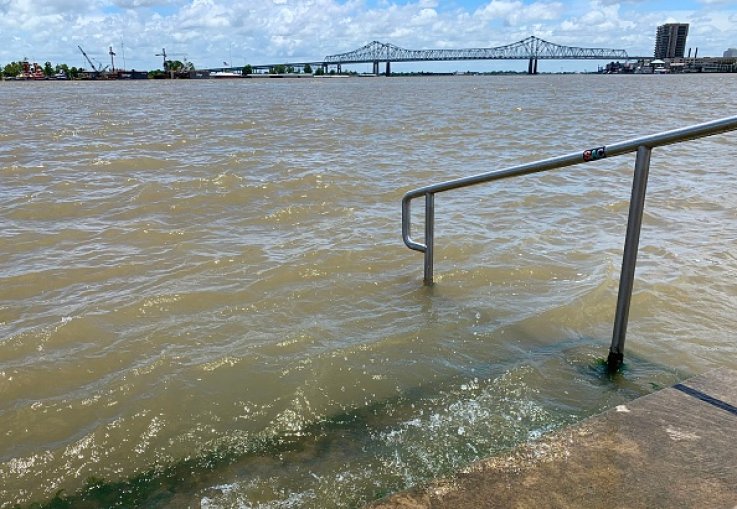
Hurricane warnings have been issued along parts of the Louisiana coastline as Tropical Storm Barry moves toward the state's shores. The storm is expected to bring heavy rains, high winds and a storm surge to a region already inundated with flood waters.
The National Hurricane Center (NHC) has issued a hurricane warning from Intracoastal City to Grand Isle, which is a swath just south of points from Lafayette to New Orleans. The New Orleans metropolitan area has been upgraded to a tropical storm warning Thursday evening, along with other inland areas westward all the way to Lake Charles.
Barry is a slow-moving storm that's still developing in the Gulf of Mexico. As of 8:30 p.m. local time, Barry's winds were recorded at 45 mph. Barry is expected to form into a Category 1 hurricane before it makes landfall between Lafayette and Morgan City on Saturday.
The storm is expected to produce rainfall between 10-20 inches across most of Southeast Louisiana and Southwest Mississippi, with some isolated areas getting as much as 25 inches, the NHC noted.
New Orleans Mayor LaToya Cantrell has not ordered mandatory evacuations, but did declare a state of emergency and has ordered city hall to close through the weekend.
"Because of intense thunderstorms, and the further potential for tropical or hurricane force winds and further thunderstorms, New Orleans may experience more widespread localized severe flooding and gale force winds that could result in the endangerment and threat of life, injury and possible property damage," said Cantrel, adding the emergency declaration warrants "all extraordinary measures appropriate to ensure the public health, safety, welfare and convenience."

The biggest threat inland is the amount of rainfall that can hit low-lying areas, especially along the Mississippi River, which winds through both Baton Rouge and New Orleans. The levees along the river are almost at flood stage, and experts at NHC say TS Barry could bring a storm surge of 3 to 5 feet, which could push water from the Mississippi River over the levees and into areas like the Lower Ninth Ward, Algiers and St. Bernard Parish.
Most models show the cone's path making its way up the Mississippi River Valley, which means the rainfall upstream would most likely make its way back down the river.
Louisiana Gov. John Bel Edwards said he expects major flooding, but anticipates the river staying below the flood walls.
"This is going to be a major rain event across a huge portion of Louisiana," Edwards said in this NBC report. "Look, there are three ways Louisiana floods — storm surge, high rivers and rain. We're going to have all three."
The governor also advised residents to take precaution during and after the storm.
Plaquemines Parish President Kirk Lepine said evacuations have begun already in his parish to the south and west of New Orleans.
"We're erring on the side of caution," Lepine said. "We want to make sure every resident is prepared and they're to understand that this government will take care of everybody in his parish."
A HURRICANE WARNING has been issued for the areas in red. Hurricane force winds are expected within 36 hours or less. pic.twitter.com/FxkuQd6QHo
— Steve Caparotta, Ph.D. (@SteveWAFB) July 11, 2019
South Louisiana has endured large hurricanes over the last 15 years, including twice in 2005 when the western side of Hurricane Katrina hit the southeastern part of the state and Hurricane Rita hit the southwestern part of the state.
Texas, including Houston and the Golden Triangle of Beaumont, Orange and Port Arthur may see some rainfall and light winds, but should escape any wrath from Barry. Texas recently went through Hurricane Harvey in 2017. Harvey dumped more than 50 inches of rain along parts of the southeastern coast of the Lone Star State.
https://www.newsweek.com/tropical-storm-barry-latest-updates-storm-track-evacuation-orders-issued-louisiana-1448874
2019-07-12 01:45:36Z
52780328776771
Bagikan Berita Ini


0 Response to "Tropical Storm Barry: Latest Updates, Storm Track, Evacuation Orders Issued in Louisiana - Newsweek"
Post a Comment